 Products & Services
 GVision is a PC version digital mapping platform which can handle various coordinate data. The system processes no change on origin data and utilizes data circularly. The product can provide visual geological chart display, and convenient and efficient mapping solution. It is wildly applied in the work of exploration and evaluation of reservoir. The main functions include map editing and output, drawing of contour line, projection transformation, geological developing mapping and universal data base.
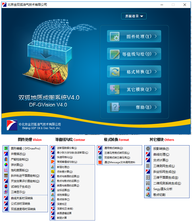
1、Accomplish Ezmap,digital oilfield with drawing maps about petroleum ,such as exploration,reservoir evaluation or development maps.
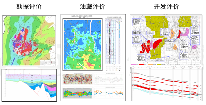
2、With the international standard symbol library and embellish library, ensure all the graphic meet the international practice.
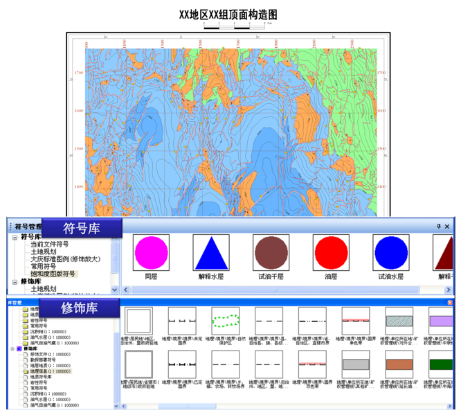
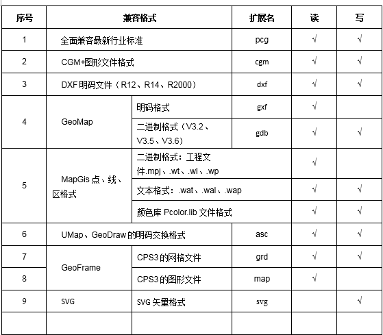
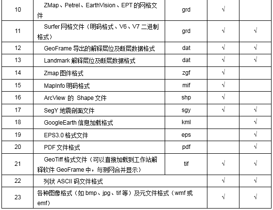
3、With a full range of mainstream geological software application interface,Accomplish keeping all the data uniformized for other softwares.
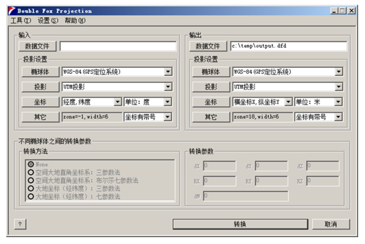
4、GDF offer the function to change the projection for different oil fields in different countries.
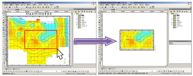
5、One step graphic random cutting, including the all geological information inside.
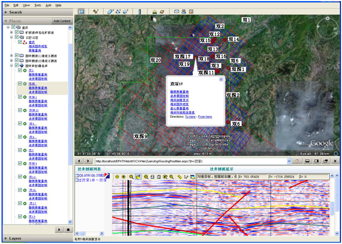
6、GDF offer the CDI with GoogleEarth. You can overlay any map on satellite photo by GoogleEarth. That makes you combine geological data with geomorphy knowledge.
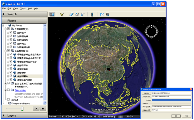
Exploration information integrated application system combined with GoogleEarth to achieve subsurface geology and surface morphology of the perfect combination.
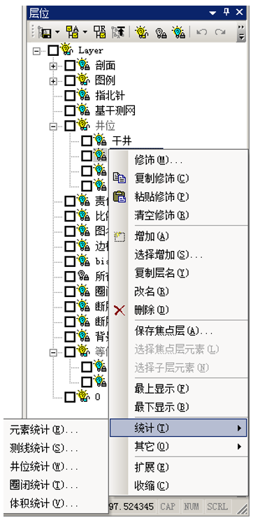
7、Powerful statistics function
Statistical functions within the specified range of elements:If the measured line statistics、Wells statistics;
Statistics under the specified element layers:Elements of statistics, statistical survey lines, wells statistics, traps statistics, the volume of statistics.
–Statistical survey line content: survey line name, start Stake, End station, Stake length, the actual length;
–Wells statistical content: well site name, category, coordinates, depth;
–Traps statistical content: traps name, high depth, closed lines, shut height, trap area.
–Volume statistics: Name, layer, area, volume, weigh the area;
Statistical results can be saved in CSV format for Excel

8、Cosmopolitan style graphics operations
>Edit, copy, paste, copy and other operations are conducted using standard international practice, easy to learn;
>Multi-step undo, redo, user-friendly maps repeated manipulation, to strengthen the protection of user actions, making the software more robust, more stable;
>Well names, contours name can directly drag with the mouse to move the location, but also by mouse drag curve shape, rotation, wrong cut;
>Curve editing forms, a single node, linear, cosine, cubic spline and other editing mode, contour editing faster and more consistent with the needs of the geological staff.
>Element attributes card management elements of the property, more convenient, user-mode analogy
>User Tools custom features, easy user-defined number of functional modules loaded into the menu;
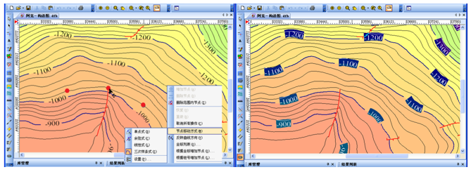
Drag and drop along the contour name
Contour professional editing functions
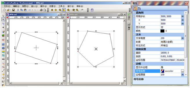
Moving, scaling, rotating, shearing element Property card
display elements parameters