Oilfield Geological Mapping
Integeration of innovative technologies, key process automation, production efficiency improvement
DFDraw is a digital geological drawing software. It’s one of he self-copyright software of Beijing GDF Oil&Gas Tech., INC. It has adopted the latest cutting edge technologies of image processing. and is tightly bound with the petroleum industry and, based on the professional knowledge ofgeophysics,, computer graphics.
Function improvement:more highly integrated
Add new module:higher Mapping efficiency
Process optimization:higher automation
I、Drawing standard
II、Map types
III、Mapping methods
1. Vector mapping
(1)Essential data preparation
(2) Data classification(Point, Line)
(3) Data acquisition and inputting(semi-automatic and automatic vectorization)
(4)Results publishing
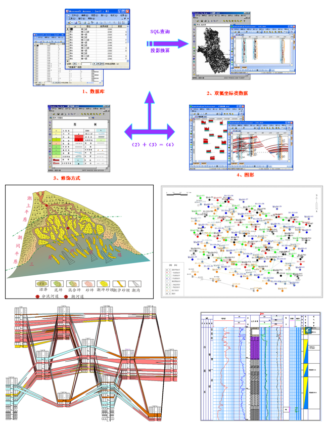
2. Data mapping
(1)Calculation mapping
(2)Database query mapping
Drawing standard
GDF geological maps meet the standard of Oil and gas geological mapping specifications and patterns, satisfies the needs of production and scientific research on geological map-making, and plays a role on unifying the standard of geological map.
The software provides the management and application of several kinds of libraries, including symbolic library, embellishment library(graphic symbol library), class library. Users could on-demand select the library.
Map types
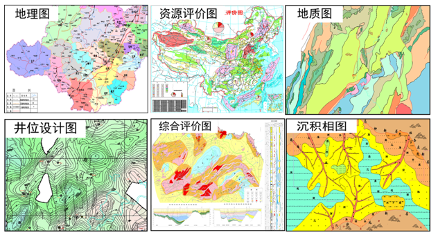
GDF Geological Mapping System is able to make large amount of geological maps in the work of oil exploration, well placement, trap evaluation, reservoir description, reserves submit, including structural map, sand shape map, well placement map, hydrocarbon-bearing evaluation map, isopach map, sedimentary environment map, comparison map, etc.
Vectorization Mapping
Entering written data into computer is called Vectorization Mapping. The purpose of the process is to convert drawing information into practical data.
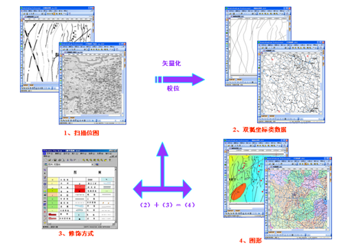
The purpose of mapping is to obtain coordinate data simultaneously when obtaining graph. Meanwhile, data could generate map.
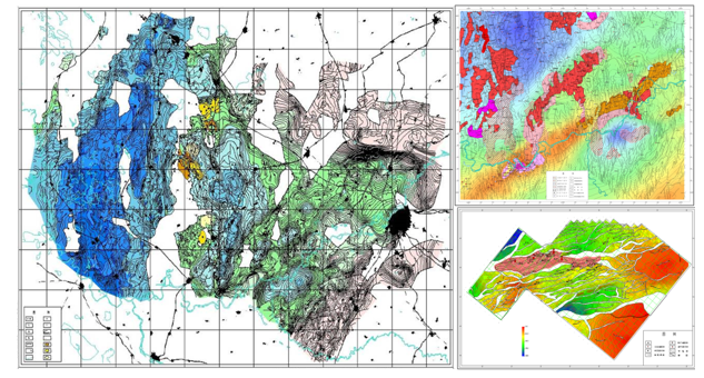
Result maps of Vectorization Mapping
Calculation mapping
According to coordinate data, Gdf Gridding Module is able to generating grid data(2D or 3D) and make contour map.
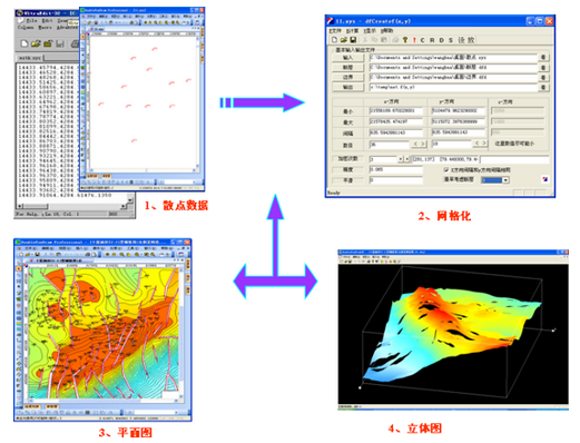
Result maps of Calculation Mapping
Database Query Mapping
